
DRONES FOR EMERGENCY
DISASTER SURVEILLANCE
DISASTER SURVEILLANCE

Drones are increasingly being used to assist emergency services with situational awareness – whether that’s assessing the scale and impact of a disaster, managing traffic flow after a road traffic collision, or monitoring an ongoing fire emergency.
Aerial images from drones can help build a picture of the emergency situation, during or after the event, so that the true scale and impact can be explored. These aerial images can be used in conjunction with existing maps, so that street and building names can overlay the aerial images to build a picture of the area, and aid with any reconstruction or additional resources that may be needed.
Due to their speed and agility, drones are likely to be used in emergency situations and natural disasters of all kinds for years to come. Advancements in technology will only further allow UAVs to mitigate the devastation caused by natural disasters, as well as become an ever more valuable tool available to emergency responders all over the world.
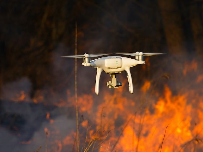
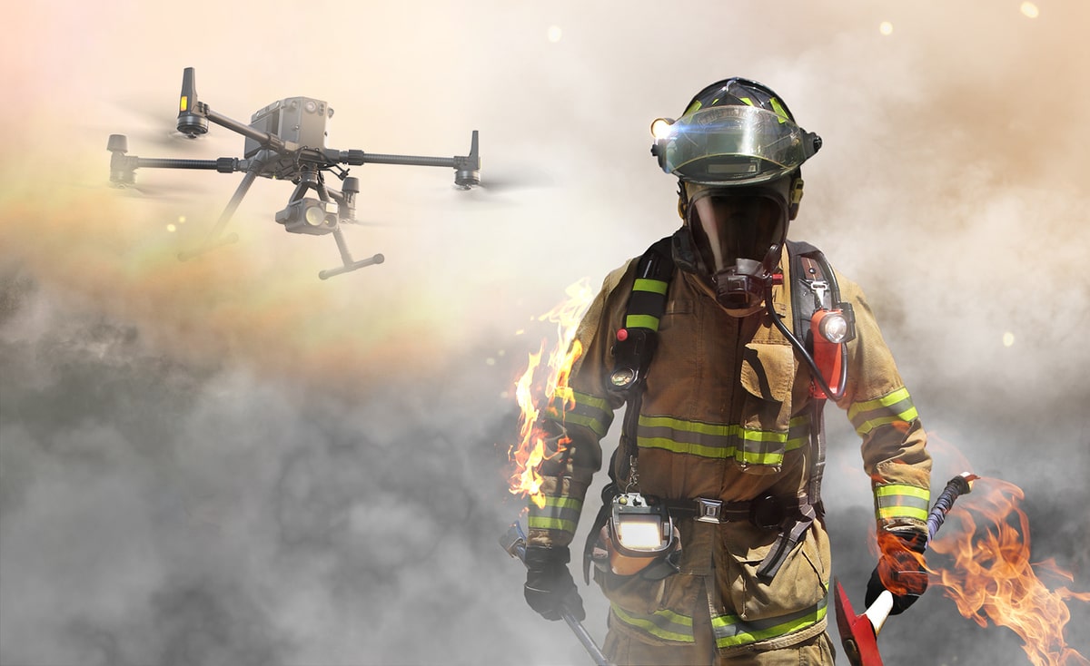
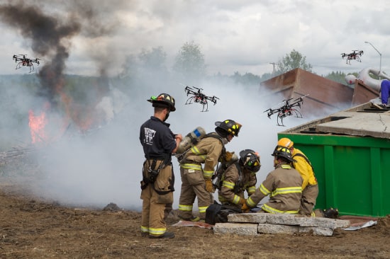
Never before has technology provided so many options for keeping your fire and rescue crews safe. Drones can give you the upper hand when confronting unknown terrain, hidden flare-ups, explosion zones, and any other area it’s not safe to scout on foot. When flown by authorized first responders, drones can operate safely near ladders, in dense urban environments, and through many other scenarios where manned helicopters would be unsafe, cost-prohibitive, or simply too late.
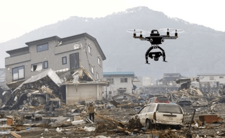
When environmental disasters strike, the first 72 hours are critical. As responders work to save lives and minimize the damage they rely on accurate geographic information to coordinate operations. The more officials know about impacted areas, the more effective their response is. Because drones can be quickly deployed over disaster zones, responders are using them to produce 3D maps, scan for victims, and assess damaged infrastructure. These, among other applications, have cemented the role of drones as an essential part of emergency disaster response.
Responders use drones to:
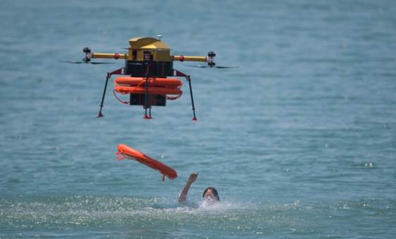
Whether in disaster scenarios or with more common search and rescue missions, it’s important that missing persons are found as soon as possible to maximize their chance of survival.
In natural disasters such as earthquakes, or in the devastation caused by explosions, people can be trapped under rubble. In floods, it’s also likely that people can get stuck in areas with no safe way to escape such as rooftops or top-floor rooms. Equally, in search and rescue missions, the terrain is often difficult to navigate, such as mountain regions or vast areas of the natural landscape.
Drones used for these types of search and rescue missions are often equipped with thermal imaging cameras which can help find missing persons in areas that are difficult to search. This not only makes them more accurate for aiding in finding survivors, but they also provide a cheaper and safer option than sending in rescue helicopters in the first instance.
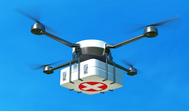
Often after a disaster, when people need it most, traditional lines of communication and delivery are disabled. In these situations, drones can not only be used to re-establish communication between parties but also to deliver essential items such as food, water, or life-saving medical supplies to those who need them. Whilst roads, rail, and water can be transient, the air is nearly always accessible.
Drones can carry out these duties much more quickly than traditional routes, as well as having the additional advantage of keeping additional personnel away from potentially dangerous areas.
Disaster recovery also involves rebuilding areas that were affected whilst also analyzing how to mitigate the effects if a similar event were to happen in the future. In the wake of earthquakes, floods, or fires, drones can assist in the safe inspection of infrastructure, so that repairs can be made more quickly than if they were done using traditional methods.
Using drones means that repairs can also be done far more safely; measurements can be taken without anyone having to set foot on-site and images of the damage can be relayed to the relevant authorities without anyone entering the fragile infrastructure.
Similarly, drones are increasingly used in the construction industry to aid in the inspection of buildings and sites to help ensure safety and monitor progress.
Site Scan for ArcGIS is the end-to-end cloud-based drone mapping software designed to revolutionize imagery data collection, processing, and analysis. Maintain a complete picture of your drone inventory and flight history with automatic fleet management. Stay up-to-date with accurate imagery, using repeatable flight plans that ensure high-quality data capture when flying your drones. Securely process imagery in a scalable cloud environment to create high-quality 2D and 3D imagery products that can be quickly shared throughout your organization, on any device. Save time by using the measurement and analysis tools to get the answers you need from your data. Directly publish your drone data to your ArcGIS organization to perform advanced drone analytics such as object detection and application of artificial intelligence (AI).
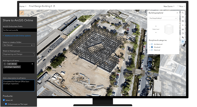
Site Scan for ArcGIS consists of two applications:
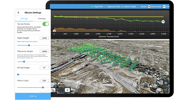
1. Site Scan Flight Planning is a flight planning and control application for drone operators that run on iOS (iPad). The app is integrated with the ArcGIS platform and allows users to plan automated flights in 2D or 3D, and allows the user to control the drone in flight.
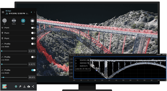
2. Site Scan Manager is a web-based application for processing, managing, and performing analysis on drone imagery. The app also includes an administrative dashboard for managing users and project permissions, available to users with administrator privileges.
Site Scan Manager creates many of the same data products as Drone2Map but is a more comprehensive solution with additional capabilities, including: