GEOGRAPHIC INFORMATION SYSTEM (GIS)

GIS is a framework for gathering, managing, and analyzing data. GIS integrates many types of data. It analyzes spatial location and organizes layers of information into visualizations using maps. With this capability, GIS reveals deeper insights into data, such as patterns, relationships, and situations. Decision-making can be possible by the analysis of different GIS layers. Currently, socio-economic and geo-spatial data is useful for the management and planning of disasters as well as tackling disastrous conditions.
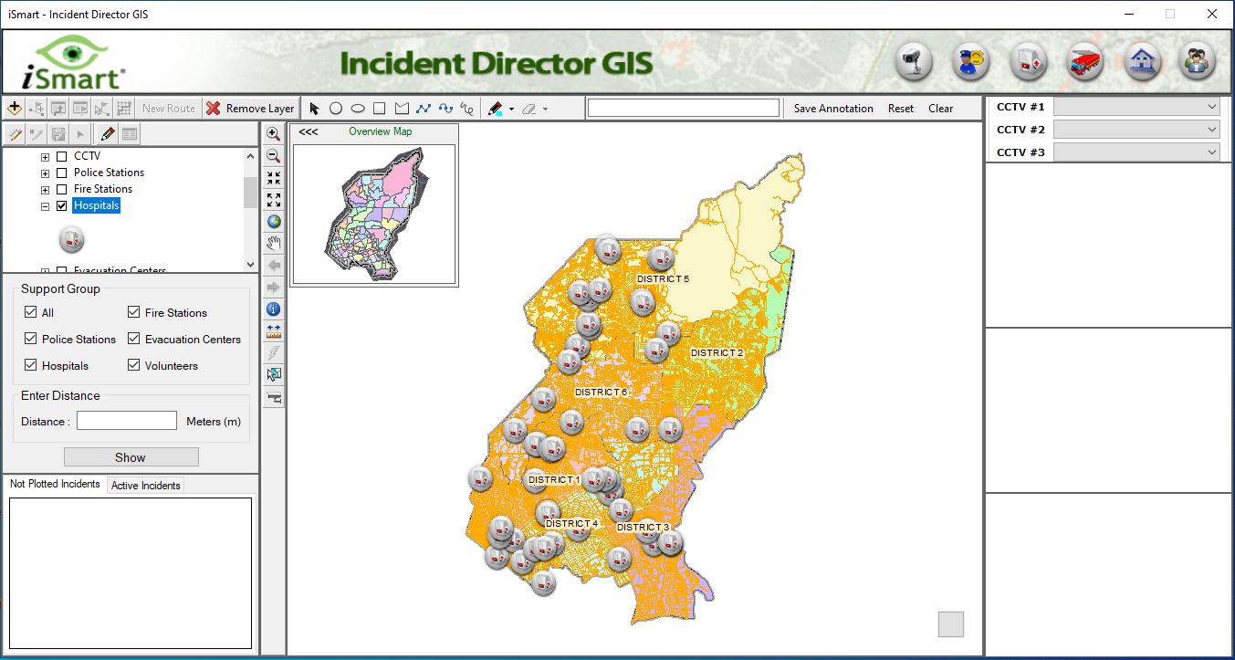
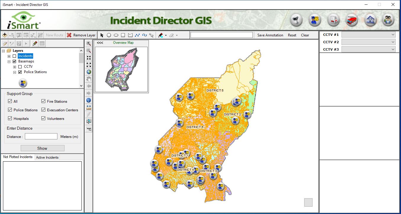
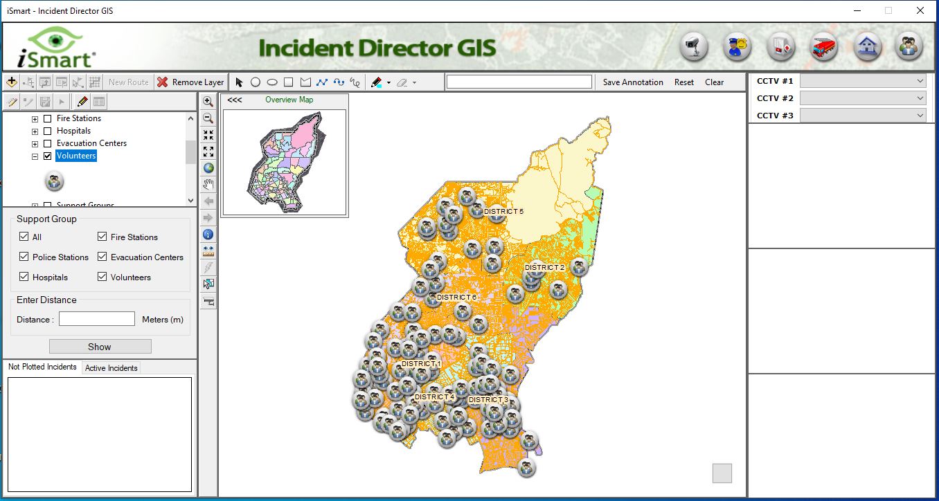
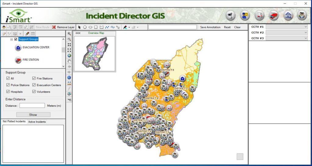
The following are the integrated features of the iSmart GIS.
Any additional Data based on the needs or specifications of the Agency can be created through data gathering and digitization.

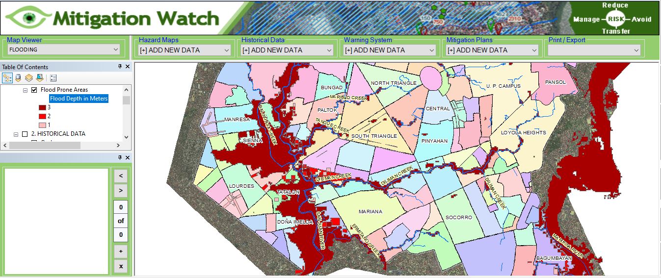
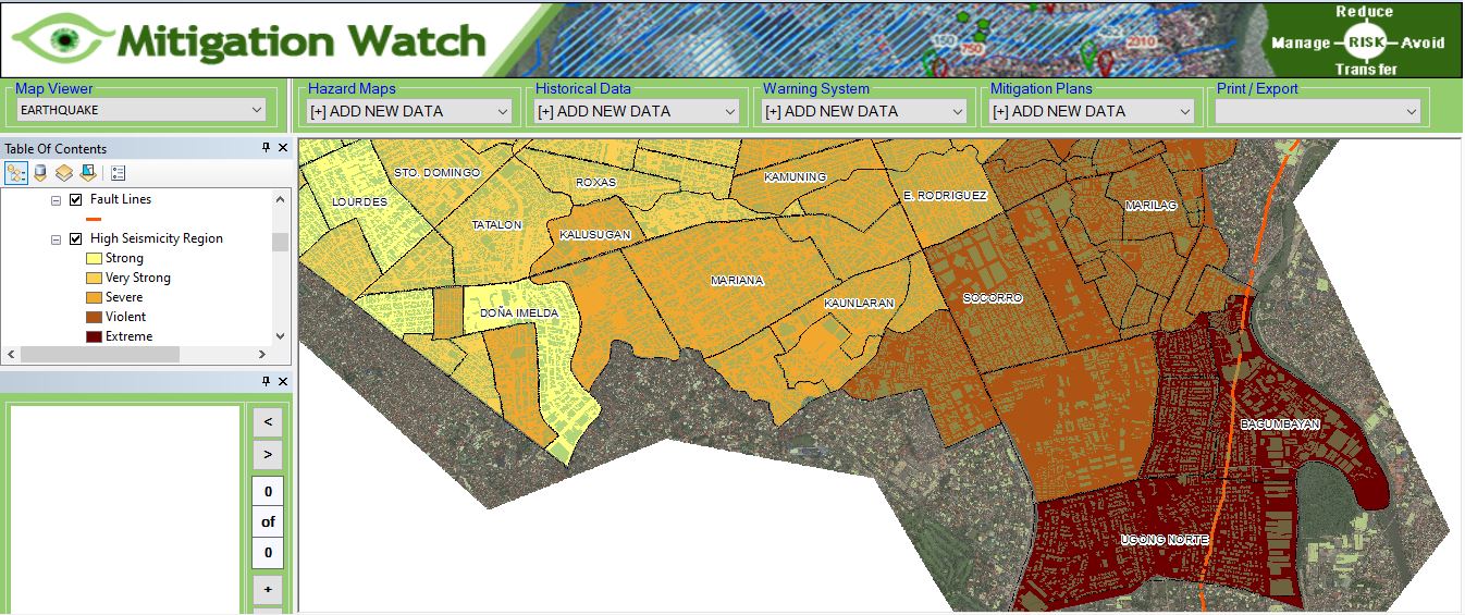
The first and the foremost task of Disaster management is to identify the disaster-prone areas of a country. With the help of GIS, Managers can Identify the areas which are likely to be affected by any disaster, this can be based on the previous data.
Planning safety measures:
Another responsibility of Disaster management is to take safety measures and make people aware of these measures. The disaster management department plans the safety measures with the help of maps or any GIS tool in the following way :
GIS is useful for hazard zone mapping and during emergency conditions mitigation of people can easily be possible use these maps. GIS is much beneficial in mitigation strategies and preparedness plans. Real-time geographic data can improve the allocation of resources for response. GIS technologies are much useful in the modeling of disaster risks and human adaptations to hazards. It also provides a decision support system in disaster management.

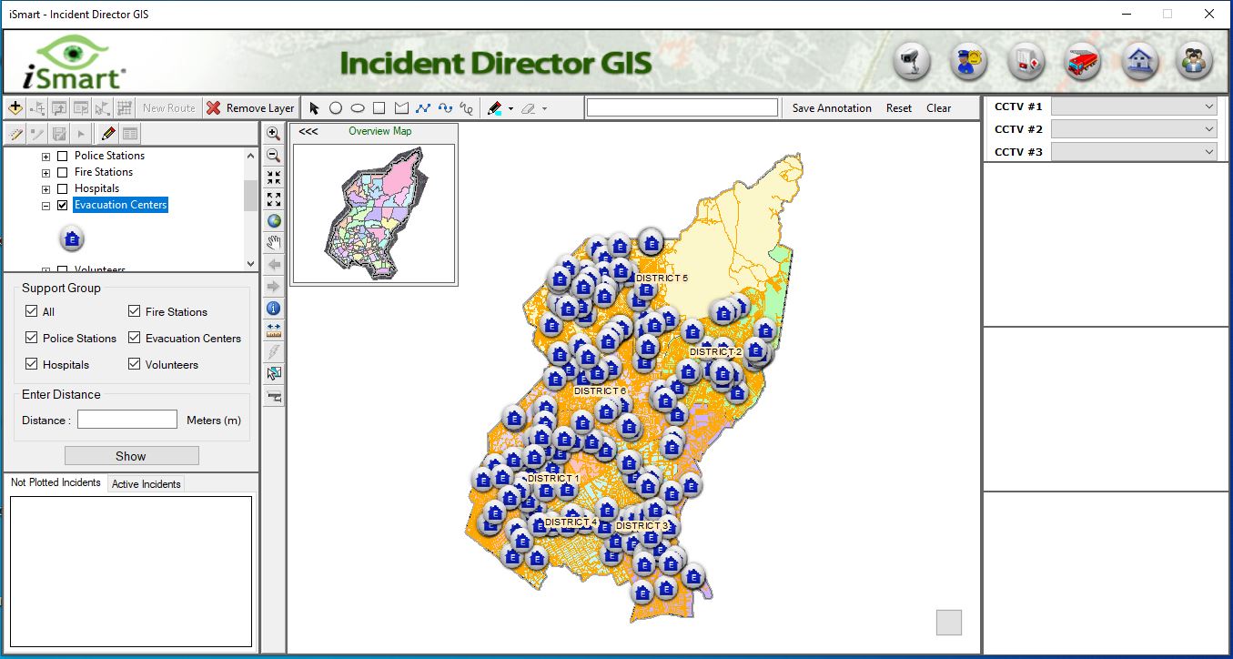
Disaster management plans the rescue and evacuation of the people, who get stuck in the calamity. GIS helps in planning the evacuation and rescue route, whether it should be by road, by water, or by air whichever will be the safest.
GIS will help to Find out the alternate ways to shelters, camps one can easily look for the nearby places where shelters and camps can be organized with the help of a map.
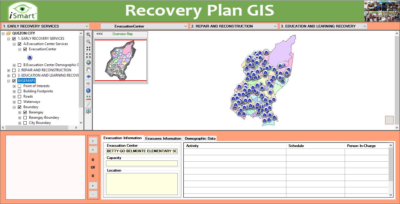
The disaster management sector makes plans for the rehabilitation of the place and people post the occurrence of the disaster.
GIS will help Identify the safe location for rehabilitation that are locations as well as zones for the rehabilitation of the victims nearby the affected place. For getting the mapping of the whole affected area we will be using GIS in Disaster Management.
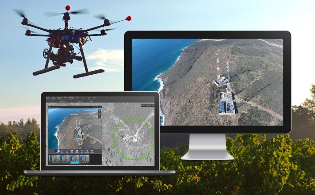
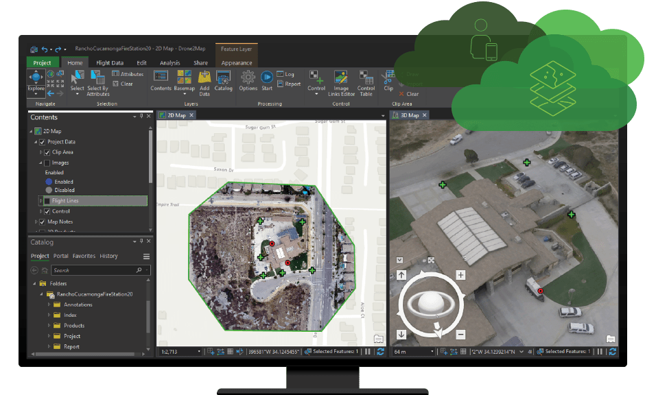
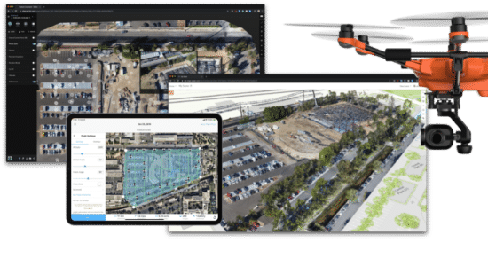
ArcGIS Drone2Map is a desktop app that turns raw still imagery from drones into valuable information products in ArcGIS. With drone hardware becoming more accessible, you can create 2D and 3D maps of features and areas that may be hard to access or fully cover because of size or terrain. Monitor environmental changes, the impact of natural disasters, scheduled events, and so on. Together with many other capabilities in ArcGIS, ArcGIS Drone2Map helps you reveal the insights hidden in your imagery. As drones continue to revolutionize how work is performed today, ArcGIS Drone2Map can help your organization gain the benefits of this emerging technology. Your organization can achieve cost reduction in aerial imaging collection, processing, and use.
ArcGIS Drone2Map features include the following: